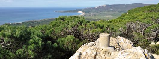
The trails are routes, marked or not, which generally run in the paths and roads, for hiking, a non-competitive sport, which takes place on roads approaching the people to the natural environment and knowledge of the territory through the historical, ethnographic and cultural.
This page is to inform the public the extensive network of paths in Cádiz province, and the valuable natural and cultural heritage of this territory.

information has been extracted from the publication "300 Trails of the Province of Cadiz representing more than 2,000 miles of inventoried roads, with so that we all know better our environment and, therefore, what we value most and are able to ensure their conservation.
Publication in PDF format and weighs 108MB you can download it by clicking on the link below
Each route is in the form of sheet, which you can find the name of the path, how to access it, information on tour, highlighting its main values, and a number of useful data that help to know the territory.

Tours ( TRACKS ) can be downloaded in GPX applications and GPS KML format to view them in Google Earth .

The 300 trails are organized by county, from north to south and from west to east. Each route is associated with a color that identifies the region in which it is situated, and has a number to locate it quickly and easily.
0 comments:
Post a Comment